Public Utilities

Topografia
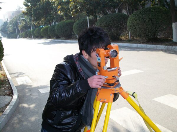
O processo geralmente envolve o uso de equipamentos como estações totais, GPS e drones. Os profissionais de topografia usam esses instrumentos para medir ângulos, distâncias e elevações, criando uma representação precisa do terreno em duas ou três dimensões.. Os benefícios da topografia Vantagens Tipos de levantamento topográfico Existem alguns tipos de levantamentos que podem ser …
Park Aerial Survey
Aerial Imaging With their ability to capture data from above, drones are able to perform land surveys, photogrammetry, 3D mapping, topographic surveying, and more, with increased efficiency. The Benefits of Drone Mapping Using drones for surveying offers the following advantages: Speed – Drones can scan acres of land in a fraction of the time it …
Highway Planning
The Community Charter defines highways to include streets, roads, lanes, bridges, viaducts and any other way open to public use.

Arquivos
Não há arquivos para mostrar.
Categorias
- Nenhuma categoria
Categorias
- Nenhuma categoria